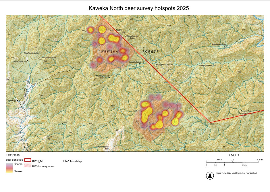
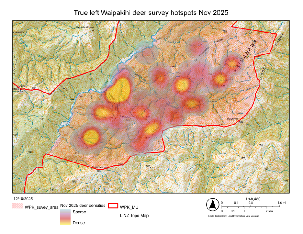
As part of the Adaptive Deer Management & Research Plan Kaimanawa & Kaweka 2022 – 2025 and deer management operations during the spring of 2025, thermal assisted surveys were conducted in two areas of interest to understand deer densities and locations.
- The True left of the Waipakihi
South of Thunderbolt Creek has areas of substantial mountain beech die back. These “die back” sites can become high activity sites for Sika deer. Managing deer impact and monitoring forest trajectory at these sites is critical to ensure canopy replacement occurs.
- Kaweka North, Te Puke Exclosure/Waimatai and Mangatainoka areas
Previous deer management operations associated with the Kaweka Mountain Beech Project that ran from 1998 to 2016 have ceased. Since then, poor herd health indicators have increasingly been observed with also little mountain beech seedling/sapling presence being documented in the 2024’s seedling ratio index monitoring.
Hot Spot mapping
The preliminary “hot spot” maps from surveys below provide useful insights into areas of higher densities. Please note: some of these detections will vary seasonally. However, the Sika Foundation encourages hunters to target hinds in these areas late March when fawns are more independent.
Click on the images to open a larger map in PDF.